British Columbia Maps Home > British Columbia Map Collection > Vancouver Island Map
Highway Map of Vancouver Island
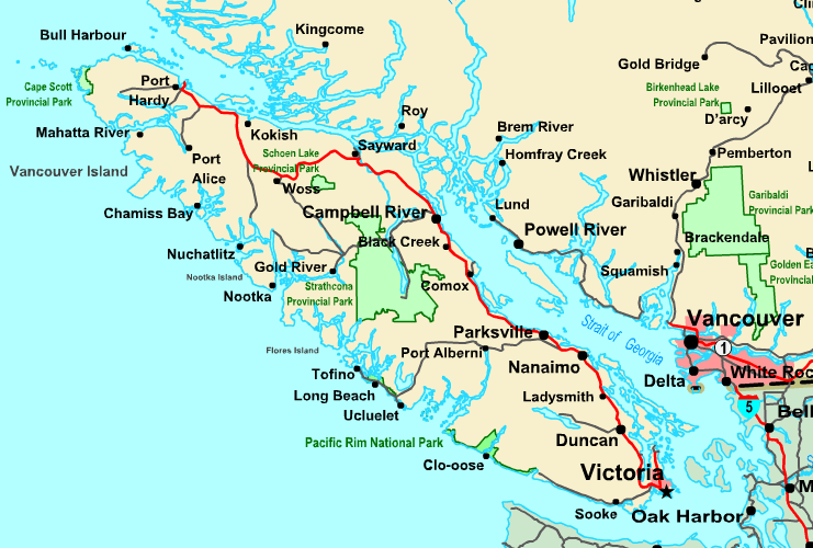
The map above is a plain projection that displays the geography of this environs with a classic array of elements.
You are granted permission to store this image and use it in your research. Giving credit to this source is always appreciated. Thank you.
In the case that you want help locating a map, a particular map, or want a nice custom map, you can contact YellowMaps.
Purchase great tailor-made maps from us. Our custom-made maps provide a wonderful variety of features, like: avenues, legend, coordinates, campsites, major agglomeration areas, springs, craters, or plains, etc. Map types range from physical to blank, travel to research, global to voting districts.
Nice maps are exact, up to date, and not misleading. First-Rate map production by YellowMaps.
To purchase actual maps that get delivered in the mail to your home, for example navigational charts, maps of continents, or wilderness maps, just dive into our map store There, you will discover more than 100,000 products.
A lot of our maps get printed on-demand. They are always available.
Back to British Columbia map collection